What I forgot to put in last nights blog was when we bought the wine. The chap in the liquor store was very friendly and recommended some local wine, however when we said where we going he aked if the route included the Douglass Pass. He remarked thst we'd passing some really ugly places.
Any, back to today. After the sun yesterday and a lack of water my partner was sick in the early morning. Nothing nasty, just wretching. A full breakfast was out there then. All she had was some dry toast and a cup of passable coffee. Me, I had a couple of danish, a coffee and toast and jam. No ill effects followed for either of us.
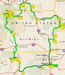
Before leaving we looked up the Dinosaur National Monument at www.nps.gov and found the centre was closed and a temporary one in its place. We altered our plans and decided to go to the main centre in, wait for it, the town of Dinosaur and take it from there. We went back to the Safeway and picked up some fuel. Whilst there I sorted the satnav and after looking a off we headed to the dinosaur national monument. We merrily bowled along the I70 looking for the turn off to Rangley. We saw several derricks and wondered what they for.
We found the turn off and started along the 139. We passed through residential areas and some industrial. I had looked the route on Google Earth and didn’t think it too bad. Fortunately it wasn’t. We were going along the valley floor most of the time until it came time to go over the Douglass Pass. The scenery was quite amazing. Pleasant open views; very green vegetation. Then we started to rise and the ground started to go away from us. There was a cliff face alongside us where once it had been open and on the further side of the carriageway there were steepish drops. The road become twistier and steeper. We had started on the rise to Douglass Pass. The car made going along this type of road. This isn’t my favourite type of road at all; sheer faces on one side and sheer drops the other. Luckily they did have barriers here; we’ve been along such roads where the barriers are non-existent! After about 20 minutes of this there was a steep rise and over the top we went. At last we had reached the summit. There was a vehicle depot here, obviously for when it gets snow. People had stopped to admire the view; we decided not to join them although there was plenty of space! Ahead the road twisted and turned downwards. This is equally as awkward as you don’t want to be sitting on the brake all the time. Anyway the road started to drop. We had passed the peak.
Slowly we made our way down followed by two bikers. We’d seen quite a few of them during the day. It seems this is biker country – they don’t wear helmets though. They stayed behind us patiently as I took it cautiously downwards. Luckily there were quite a few straight level stretches allowing the foot off the brake pedal. Then, quite suddenly, we were at the bottom. Within five minutes or so I was able to let the bikers get past and they disappeared into the distance. The scenery here was different. There were quite a buildings and signs of industrial activity as we went past some of them we could see that it was related to gas pipelines which explained something we had seen earlier. We had seen pipes being laid and speculated what they were for. Now we knew, gas. The drive was easy now, flat roads with the occasional twist in it; flat land on one side with gulches cut by a hidden river on the other.
We pulled into a area that had a point of interest but that was nothing as to the person there. He was biker grey bearded, red spotted bandana on his head, dark glasses, short and stocky. He was brilliant to talk to. He was from Rifle, and was heading home. He couldn’t place where we were from and we went into the usual rigmarole. However he was interesting that he found that the scenery was being destroyed by the gas companies and that the oil companies weren’t cleaning up the old fields as they finished with them although the old mining companies were. We chatted on for a while and he headed off as we did.
Not much further down the road we saw what he meant. It was as if a scrapper had been drawn across the landscape and all the plants removed leaving bear sandy soil and old oil drilling machinery. Very eerie. There were a few ‘nodding donkeys’ still pumping oil. A very desolate landscape.
We stopped in the town of Dinosaur(!) and went to the Dinosaur information center. It was right on the junction with SR 40, which made it easy to find. A really nice, helpful assistant gave us lots of information and again we chatted to her. There have been quite a few English and Belgium visitors this year it turns out. Anyway she gave us information on both the Colorado and Utah parts of the National Monument plus a cup of coffee, which was much needed.
We sat outside, no one else was there except for a lone looking rabbit which hopped off to we know what where. We ate some yoghurts we had picked up at breakfast and a couple of apples and decided to head for the Utah side of the monument.
As we approached it across a very flat landscape with the rock faces towering over it we could see some very black and thunderous clouds. All day we had brilliantly sunny and hot weather. We knew that the original centre was closed because it was falling apart. The temporary centre wasn’t a match on what we had seen of the original. We watched the video and decided to go on the shuttle tour. However, it started to rain and in the distance, lightening. We went on a min-hike around the area as we waited for the tour. When we got back we were told it had been cancelled due to the rain and the lightening but ‘you could get the self-guided tour for 50c from the store’ which we did. The rain eased off and so did we.
Well, you can imagine that we weren’t best pleased to see the ‘cancelled tour’ suddenly appear. As we headed up to the first stop, where it was too, the ranger came across and apologized claiming that it was her supervisor that had cancelled and then reinstated it. As it so happens it did us a favour because we went off-road on a trail that the bus couldn’t go along. The route took us to various petroglyphs in the rocks drawn by the Fremont peoples some 1000 years ago – not that long ago. The off-road tour went to an old cabin that had been occupied by a lone woman who really lived the independent life-style; no electricity or gas; the running water was from a stream but she had married and had children and it was only the fall from her horse at the age of 90 that finally did for her and that was in the early 1990s. A real game old bird. We looked at the various points along the way and after that decided to head off to our lodgings in Vernal, Utah.
Nothing exciting or particularly interesting except to report that the influence of the Mormons becomes quite evident in the news reports, signage and such like.
I tried to find a local store using the internet and it’s a real pain to do that. Instead I looked up various stores we knew about and found there was Wal-Mart near us, which we failed to see as he went out to look for it but after turning around and heading back we then spotted it. We bought some food there, which seemed to be the local hangout for those of a rotund shape and with nothing much better to do than fill shopping trolleys with screaming children and food.
One irritating thing has happened and that’s my ipaq with the satnav, has lost my contacts list. I think it was when I was doing things at work with this laptop and when it synchronised with it the laptop wiped the list!